Thousands of earthquakes in recent weeks have shaken the Icelandic fishing town of Grindavík, about 30 miles (50 kilometers) southwest of the capital Reykjavik. They have triggered evacuations and warnings that a volcanic eruption may be imminent.
While the idea of magma rising was no doubt scary for tourists visiting the nearby Blue Lagoon geothermal spa, which was closed as a precaution, Iceland’s residents have learned over centuries to live with their island’s overactive geology.
So, why is Iceland so volcanically active?
The answer has two parts: One has to do with what geologists unimaginatively call a hotspot, and the other involves giant tectonic plates that are pulling apart right beneath the island. As a geologist, I study both.
Life on the edge of two tectonic plates
When plate tectonic theory was emerging in the 1960s, geologists realized that many volcanoes are located in zones where tectonic plates meet. Tectonic plates are gigantic chunks of Earth’s rigid outer layer that carry both continents and oceans and are constantly in motion. They cover the planet like large pieces of a spherical jigsaw puzzle.
Many of these volcanoes are in subduction zones, like the Pacific’s Ring of Fire, where thinner oceanic plates slowly sink into Earth’s mantle. These are the postcard stratovolcanoes like Mount Fuji, in Japan, or Mount Rainier, outside of Seattle. Because of their high gas content, they tend to erupt catastrophically, shooting ash high into the atmosphere with the energy of nuclear bombs, as Mount St. Helens did in 1980.
A second, typically quieter kind of volcano forms where plates pull apart.
The volcanic activity near Grindavík is directly related to this kind of plate tectonic motion. The mid-Atlantic ridge between the Eurasian and North American plates cuts right through that part of the island.
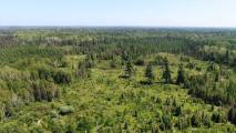
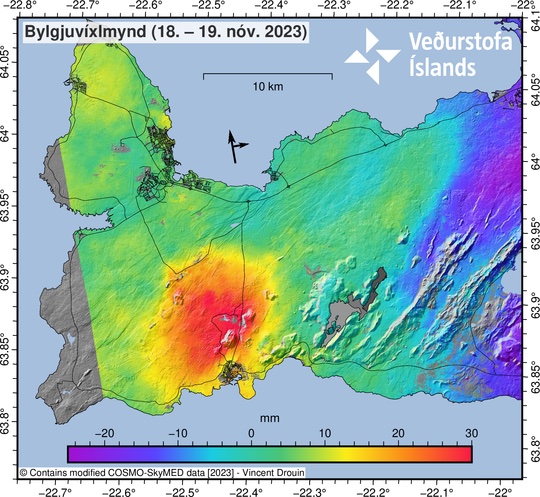
In fact, at Thingvellir National Park you can literally walk between the two tectonic plates. You can see the topographic scars of the rift in the long, linear valleys that extend to the northeast from Grindavík. They align with the recent swarm of earthquakes and the ground deformation that is happening.
Radar satellite data from the Icelandic Meteorological Office show that a broad area around Grindavík sank by about 3 feet (1 meter) over 10 days, and the GPS station in town moved about 3 feet (1 meter) to the southeast with respect to the North American plate from Oct. 28 to Nov. 9. Large cracks have broken streets and houses in Grindavík.
Where plates pull away from each other, the underlying mantle rises toward the surface to fill the gap, carrying its heat with it and moving into an area of lower pressure. Those two processes cause melting at depth and volcanic activity at the surface.
Starting in October 2023, this pressurized magma began pushing its way along a fissure toward the surface, triggering the earthquake swarms and creating the possibility of an eruption.
This is the same process that creates new oceanic crust underwater at mid-ocean ridges. After the magma solidifies as basalt rock, it will look like vertical walls intruded into the surrounding area. The Grindavík dike appeared to have reached within about 0.6 miles (1 kilometer) of the surface by Nov. 14 and could soon reach the surface.
Sitting on a hotspot
In Iceland, the large volcanoes in the interior also appear to be over a mantle plume, similar to Hawaii.
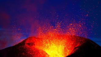
This kind of volcano typically erupts basalt lava, which melts at very high temperature and tends to flow easily. Eruptions are generally not explosive because the runny lava allows gases to escape. This is the reason why tourists often can safely watch lava flows in Hawaii or Iceland.
Exactly what causes hot material to rise at hotspots is still debated, but the most commonly accepted idea is that they are caused by plumes of super-heated rock that originate at the transition between Earth’s metallic core and rocky mantle. Hotspots are a mechanism for the Earth to give off some of its internal heat.
If there is an eruption in Iceland, the basaltic lava will most likely flow relatively peacefully downhill, as it did when Fagradalsfjall volcano erupted in 2021-22 just east of Grindavík, until it reaches the sea. However, when lava that is 1,800 degrees Fahrenheit (about 1,000 Celsius) hits water, it will flash to steam, causing explosions that can scatter ash over a large area.
A silver lining of Iceland’s volcanoes
Living in an active volcanic area has some advantages, particularly for energy.
Iceland derives 30% of its electricity from geothermal sources that use underground heat to drive turbines and produce power. It’s almost like a controlled version of a lava flow hitting the sea, and it helps make Iceland one of the cleanest economies on earth.
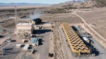
A hydrothermal plant called Svartsengi, near Grindavík, uses the underground heat to provide hot water for several thousand homes plus 75 megawatts of electricity. The plant pumps water through wells drilled into the volcanic field. This water boils to steam, which is then fed to turbines that generate power and to heat exchangers that make hot water for direct heating of homes.
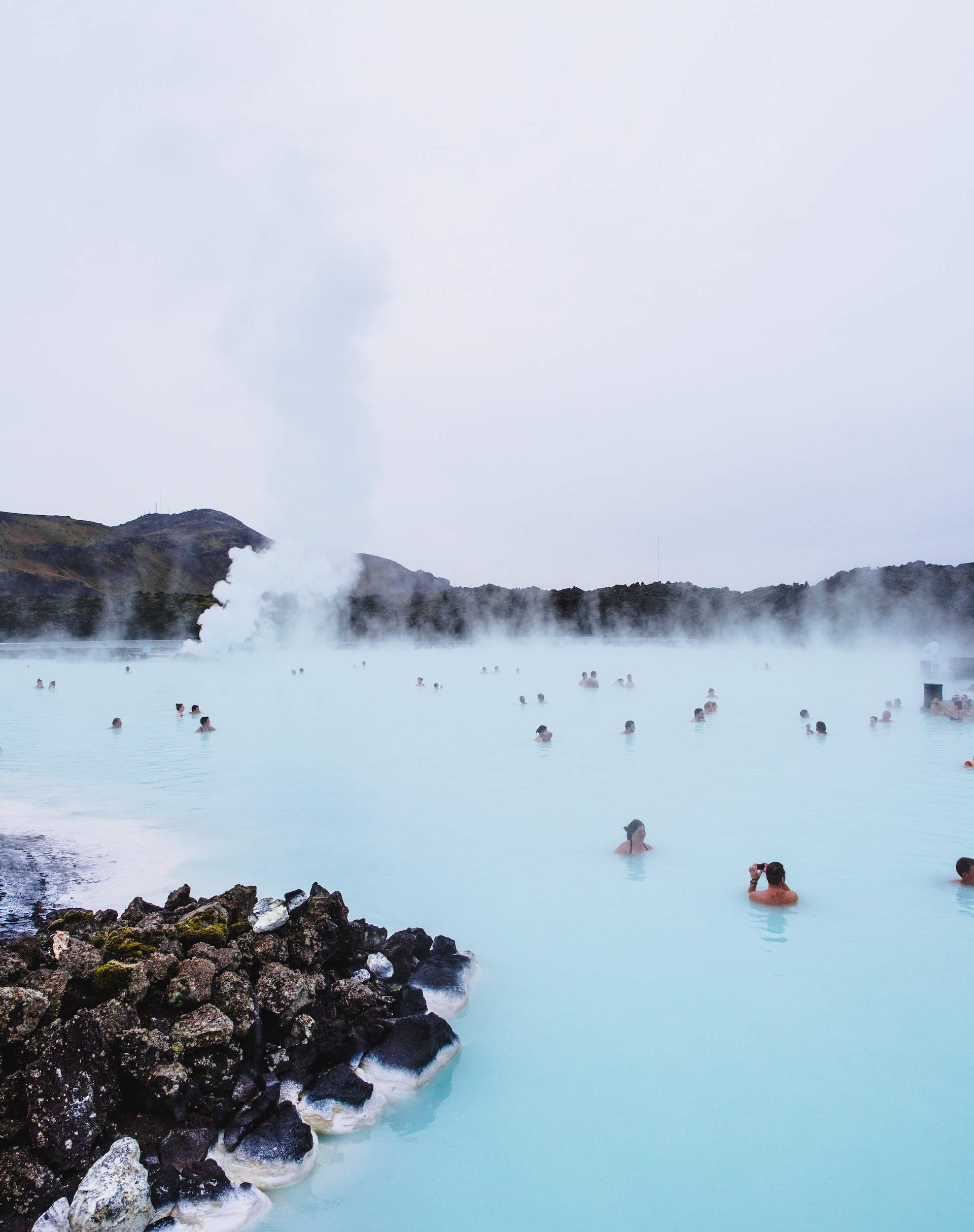
That power plant is also part of the reason the Blue Lagoon is so popular. When the power plant was built in 1976, the plan was to discharge its still hot wastewater into an adjacent low area, expecting that it would seep into the ground. However, the geothermal water was loaded with dissolved silica, which became solid minerals when the water cooled, creating an impermeable layer. A small lake began to form.
Because of its high silica content, the water in this lake is a spectacular blue color that inspired the creation of the geothermal spa. The Blue Lagoon is now one of the top tourist attractions in the country.
This article is republished from The Conversation under a Creative Commons license. Read the original article.