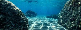
We have better maps of the moon’s surface than of the ocean floor here on Earth — but that’s a problem researchers at MIT aim to solve.
They’ve created an underwater navigation system that could make it possible to map the 80% of the seabed that’s still a mystery, potentially improving everything from studying marine life to combating climate change.
Ocean Floor Mapping
Right now, autonomous rovers are driving across the surface of Mars, collecting data scientists will then use to create ever more detailed maps of the Red Planet’s surface.
So, if we can get rovers to Mars, why can’t we just unleash an army of autonomous underwater vehicles to explore every inch of the ocean floor for us?
“The answer is: We will lose them,” researcher Reza Ghaffarivardavagh told MIT News.
Scientists use radio waves to communicate with off-world rovers (the same kind of signals that power GPS technologies), but those waves quickly break down underwater.
Instead, scientists use sound waves to track objects in the ocean — they strap a device that emits sound to a whale (or underwater drone), set up sonar to capture the sounds, and use the data to determine the object’s location.
The reason we haven’t been able to use sound waves to keep track of fleets of underwater drones to map the ocean floor is that the devices that emit the sound waves — the ones we’d attach to the drones — require batteries that are quickly drained.
That makes the technology less than ideal for exploring an area greater than 100 million square miles (that’s how much of the ocean floor is still unmapped).
The UBL Navigation System
To overcome this problem, the MIT team created Underwater Backscatter Localization (UBL), a new kind of underwater navigation system.
Rather than strapping a sound-emitting device to an object to track it, the UBL system has a receiver that emits sound waves at different frequencies.
A sensor on the object then reflects those sound waves back to the receiver, which determines the object’s location based on when the waves return.
We’re hoping to understand the ocean at scale.
Fadel Adib
The power the sensor needs for the reflection process comes from the sound waves themselves — the force of them hitting the sensor generates an electric charge.
The UBL navigation system still requires more development, but it did work in proof-of-concept testing, and the researchers believe it could one day help us map the ocean floor, track animals for conservation efforts, study the impact of climate change on the ocean, and more.
“There are so many applications,” lead researcher Fadel Adib told MIT News. “We’re hoping to understand the ocean at scale. It’s a long-term vision, but that’s what we’re working toward and what we’re excited about.”
We’d love to hear from you! If you have a comment about this article or if you have a tip for a future Freethink story, please email us at [email protected].