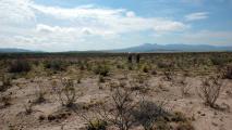
To us humans, the shape and location of oceans and continents seems fixed. But that’s only because our lives are so short.
If our existence spanned hundreds of millions of years instead of just a handful of decades, we would see land masses constantly merge and break up again, their dance around the earth powered by a near-continuous orgy of earthquakes and volcanic eruptions.
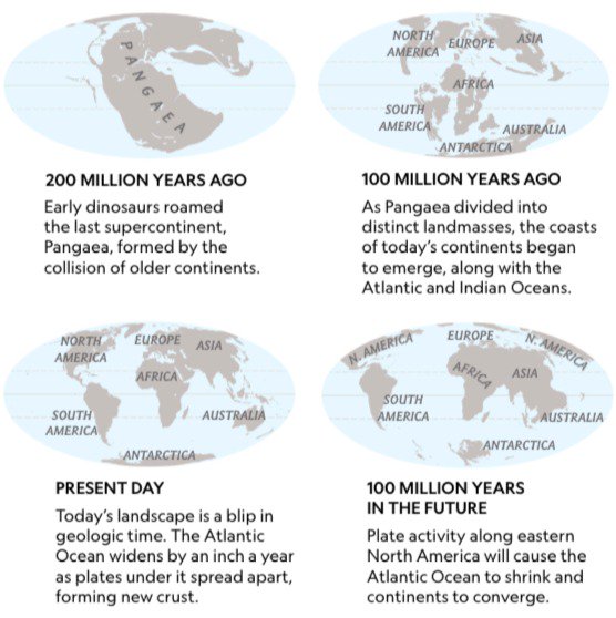
For at least a few times already, all of our planet’s dry bits have come together to form a single, giant island in a single, giant sea. Roughly 200 million years ago, Pangaea was the last iteration of this recurring supercontinent (1). That deep history will repeat itself. In another 250 million years, we’ll have the next supercontinent. We’ve already got the name: Pangaea Proxima.
Here’s what our world will look like at that time: the Americas attached to Africa in the north and Antarctica in the south; Africa slammed into Europe and the Middle East; and Australia welded to Asia’s east. The giant continent is centred around the remains of the Indian Ocean, now an interior sea mirroring the former Mediterranean, with a boot-like India posing as a replacement Italy.
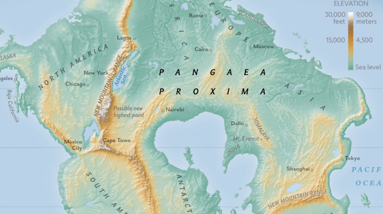
Where continents have collided, new mountain ranges have arisen. The world’s new high point is no longer located in the Himalayas, but in the as yet unnamed range that has sprung up where Florida and Georgia have slammed into South Africa and Namibia.
It’s unlikely that there will be any humans around to witness the reunification of the world’s land masses – we’ll be lucky to survive the next century, let alone the current millennium – but the map includes some present-day cities nevertheless, for your orientation.
Or more likely, for your disorientation. On Pangaea Proxima, Cape Town and Mexico City are just a day’s drive apart. Lagos is to the north of New York, and both are close to the Atlantic Sea, the shrunken remnant of the former ocean. And you could travel from Sydney to Shanghai and on towards Tokyo without having to cross a single body of water.
Europe has attached itself to Africa, and Britain – Brexit notwithstanding – has rejoined Europe. One thing has remained reassuringly the same: New Zealand is still an isolated place, forever threatening to fall off the bottom right part of the map.
This map is featured in the new (July 2018) issue of National Geographic Magazine. More on that here. Thanks to Martin Foldager for sending it in.
This article was reprinted with permission of Big Think, where it was originally published.